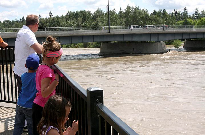
On June 20th, 2014 water levels in the Red Deer River reached heights of 1335m3[1]. While high, this level of river water was lower than expected and proved to be more manageable than levels reported in other areas of southern Alberta. To prepare for potential flooding, a local state of emergency was declared on the evening of June 19th to ensure emergency officials could prepare for approaching flood waters. In addition to local evacuations, approximately five hundred southern Albertans impacted by the floods were housed in a provincial reception centre in Red Deer[2]. High water levels on the Red Deer River prompted a series of precautionary actions and preparations for the City of Red Deer, however, the outcome was much less damaging and impactful than in other areas of southern Alberta.
Sufficient preparation time and lower than initially projected water levels contributed to the minimal damage experienced by the City. Additionally, the Dickson Dam located upstream of the Red Deer River was able to reduce river flow rates and regulate the quantity of water heading downstream to communities like Innisfail and the City of Red Deer[3]. Operations at the Dickson Dam and forecasts from Alberta Environment provided necessary information to City of Red Deer emergency officials and citizens over the course of the flood which, resulted in successful response and preparation measures.
Share this Post:
We provide Canadian educational resources on water practices to promote conservation and sustainability. Our team crafts current and relevant content, while encouraging feedback and engagement.
The Canada WaterPortal is a registered charity, #807121876RR0001
We recognize and respect the sovereignty of the Indigenous Peoples and communities on whose land our work takes place.
© 2025 All Rights Reserved.