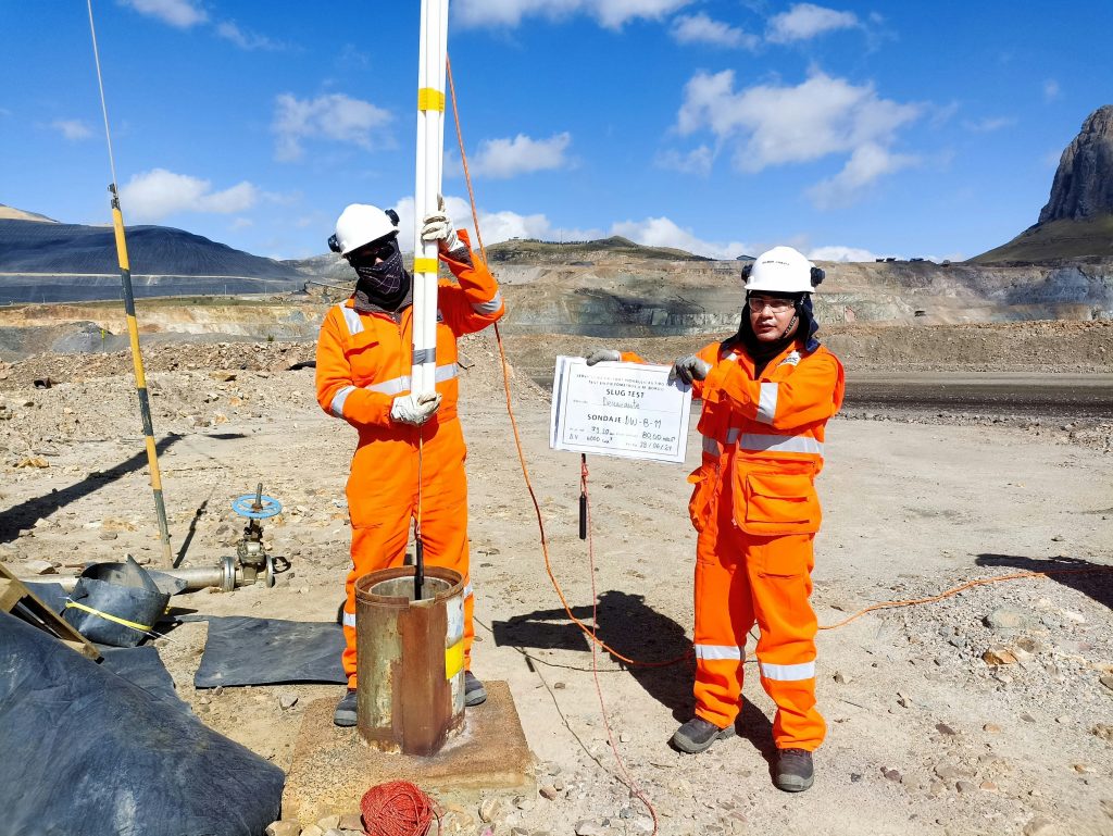
Groundwater is monitored and observed through the use of monitoring wells and water quality samples. Hydrogeologists install monitoring wells to better understand where the water is beneath the surface. Wells can be drilled deep into the earth, kept shallow near the surface, or anywhere in between.
Once installed, a well can be used by hydrogeologists to monitor groundwater. Hydrogeologists are able to measure the distance from the earth’s surface to the water table. They can also test water quality and obtain other, more complicated, data. For example, if water is pumped from a well for an hour and then pumping stops, you could measure how long it takes for the water level to return to normal. Combined, this information gives hydrogeologists the data they need to estimate the location and quantity of groundwater. Given enough data, the water table for a site or region can be mapped. More recently, advanced technology such as remote sensing and isotopic fingerprinting has been developed which can more precisely estimate where the groundwater is located below the surface.
In Alberta, the Government of Alberta (GoA) has a team of hydrogeologists who install and operate monitoring wells across the province. Additionally, Natural Resources Canada (NRCan) is also mapping the major aquifers in Alberta. There remain some data gaps around groundwater. The GoA and academia have studies that are aiming to fill many of these gaps [1]. Similarly, other provinces have their own monitoring. For example, Ontario has its Provincial Groundwater Monitoring Network [2] and Nova Scotia has its Groundwater Observation Well Network [3].
The GoA operates over 300 monitoring wells across the province, 57 of which transmit data in near real-time to AEPA and 177 are used to monitor water quality [4]. These wells have sensors that continuously record groundwater levels. The information collected by the GOWN is used for AEPA’s Condition of the Environment reporting [5].
The purpose of the GOWN is to create a baseline for groundwater levels in Alberta. Once there is an extensive baseline, the wells can monitor activity to see whether human influence is causing fluctuations in the elevation of the water table. The GoA took over the GOWN from the Alberta Research Council in 1982 which at that time included 55 provincial wells and 90 wells in the oil sands area. To date, the data have been used to map the water table and the distribution of chemicals in groundwater within Alberta; assess industrial and agricultural impacts on groundwater; observe long term changes in water levels to examine the impacts of drought; and assess the groundwater/surface water interactions.
In Alberta, a program to inventory and map the provinces groundwater resources began in 2008. Since then, a “groundwater atlas” has been released for the Edmonton-Calgary corridor [6].
NRCan runs four programs to better understand groundwater supply in Canada [7]. A lot of work is being done to understand and describe aquifers and groundwater from the perspectives of vulnerability, seasonal changes, physical extent, contamination, etc. This is leading to the development of risk-assessment tools and guidelines to support decision-makers in both government and private sectors.

Groundwater is not studied as much as surface water since it cannot be seen directly. Studying groundwater can be time consuming and costly, making it difficult to study. Some common data gaps related to groundwater include information on: groundwater-surface water interactions, water well databases and groundwater chemistry.
Consumptive groundwater use is the amount of groundwater that is pumped which is not returned through recharge (water on the surface that enters the groundwater system).
There is relatively little known about groundwater-surface water interactions and since monitoring wells are only in some parts of Canada, groundwater chemistry is also not well known. There is a high amount of uncertainty with water well databases. Consumptive values are estimated based on recommended pumping rates, but since owners rarely supply this data and may not be required to do so, actual pumping rates are not available [8].
For example, the extent of the main buried valley aquifers in Alberta is known (such as the Calgary Buried Valley Aquifer, Beverly Channel Aquifer, Whisky Valley Aquifer, Gregoire Channel Aquifer, and the largest, the Hatfield Valley Aquifer of the Empress Group), but only parts (such as the Cold Lake area) have been mapped in detail. This means that there is knowledge about location and size of the aquifers but further detailed studies and mapping projects are needed to fully understand the detailed geology of these aquifers. Certain areas have a higher priority for being mapped because the knowledge is critical in supporting use of groundwater.
Another major data gap is around groundwater chemistry. Groundwater chemistry is essential when determining if an aquifer is suitable for pumping because water chemistry will determine how the water is extracted. If groundwater is very saline, special pumps are needed and if it has a high amount of arsenic the water will have to be treated once it is pumped.
In the prairies of western Canada groundwater often has natural trace elements (chemical elements such as arsenic, fluorine, lead or zinc that are naturally present in very small concentrations) that exceed amounts recommended by drinking water regulations. If the groundwater is to be used for drinking water, treatment may be needed [9] prior to using the water.

In academia, research is currently being conducted to fill knowledge gaps on Groundwater. Some examples of that research are below.
[1] Government of Alberta, n.d., Groundwater – Science and knowledge. https://www.alberta.ca/groundwater-science-and-knowledge.aspx.
[2] Government of Ontario, n.d., . https://www.ontario.ca/page/map-provincial-groundwater-monitoring-network.
[3] Government of Nova Scotia, n.d., Groundwater Observation Well Network. https://www.novascotia.ca/nse/groundwater/groundwaternetwork.asp.
[4] Government of Alberta, n.d., Groundwater Observation Well Network. https://www.alberta.ca/lookup/groundwater-observation-well-network.aspx.
[5] Government of Alberta, n.d., Condition of the environment. https://www.alberta.ca/condition-of-the-environment.aspx.
[6] Government of Alberta, n.d., Provincial Groundwater Inventory Program. https://www.alberta.ca/provincial-groundwater-inventory-program.aspx.
[7] Government of Canada, 2023, Geoscience: Groundwater and aquifers. https://natural-resources.canada.ca/earth-sciences/earth-sciences-resources/geoscience-groundwater-and-aquifers/10909.
[8] Rivera, A. 2014. Canada’s Groundwater Resources. Fitzhenry & Whiteside. https://doi.org/10.4095/293431.
[9] Health Canada, 2006, Guidelines for Canadian Drinking Water Quality: Guideline Technical Document – Arsenic. https://www.canada.ca/content/dam/canada/health-canada/migration/healthy-canadians/publications/healthy-living-vie-saine/water-arsenic-eau/alt/water-arsenic-eau-eng.pdf.
[10] Estimation of Recharge and Nutrient Leaching at Different Scales to Improve Sustainable Land and Groundwater Management. University of Manitoba. https://home.cc.umanitoba.ca/~hollaenh/projects/Recharge.html.
We provide Canadian educational resources on water practices to promote conservation and sustainability. Our team crafts current and relevant content, while encouraging feedback and engagement.
The Canada WaterPortal is a registered charity, #807121876RR0001
We recognize and respect the sovereignty of the Indigenous Peoples and communities on whose land our work takes place.
© 2025 All Rights Reserved.